TS Go!
Total station, project, DXF, stakeout, surveying and point control in the field.
Field apps
Android apps for surveying and construction: total station, optical level, project files, stakeout, survey points, construction layout, elevations and field calculations.
Total station, project, DXF, stakeout, surveying and point control in the field.
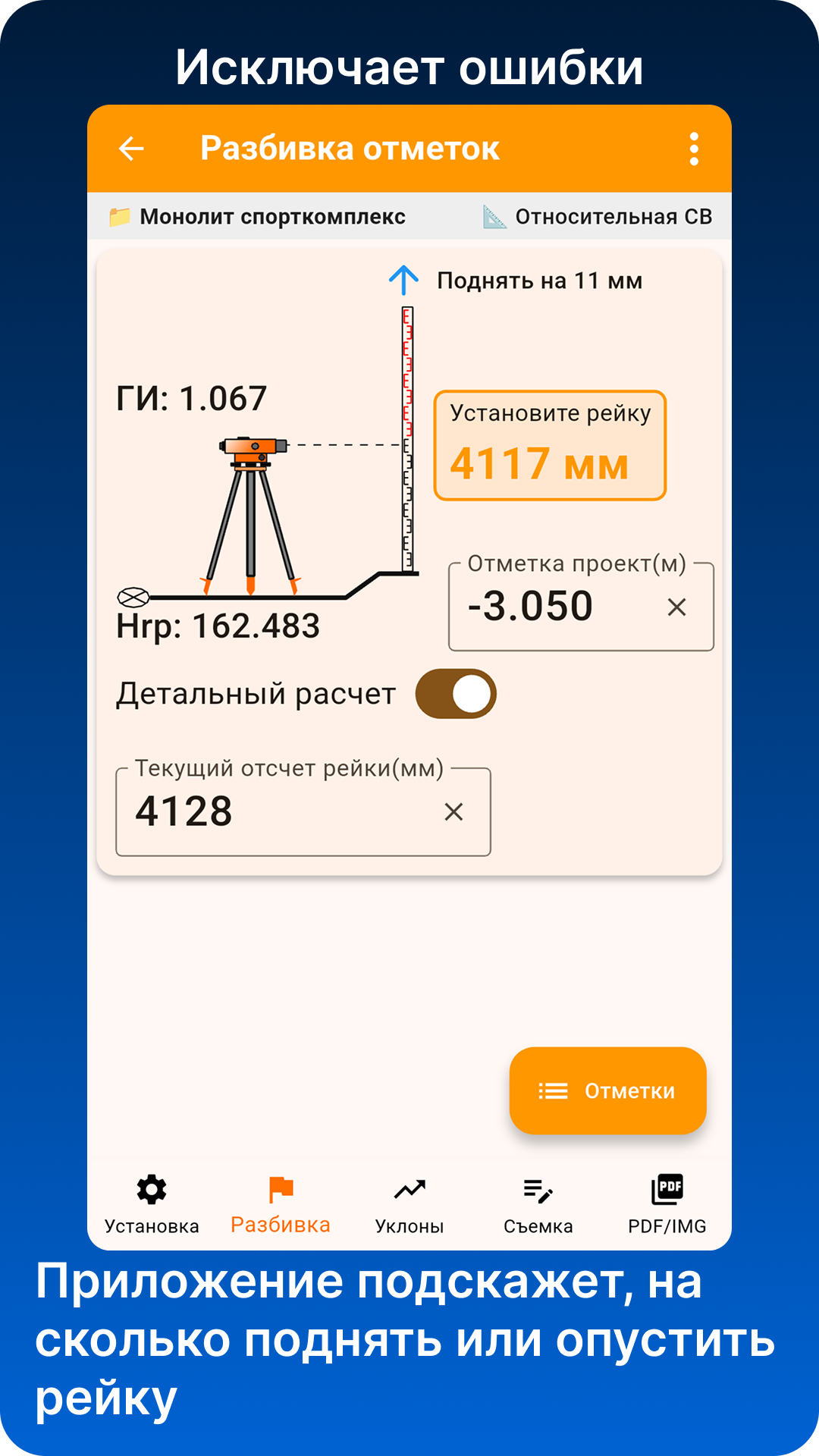
Benchmarks, staff readings, instrument height, elevations, setting-out marks and level survey.
Products
The goal is simple: get a clear result on site — measured point, design line, offset, elevation, staff reading, design elevation and construction layout.
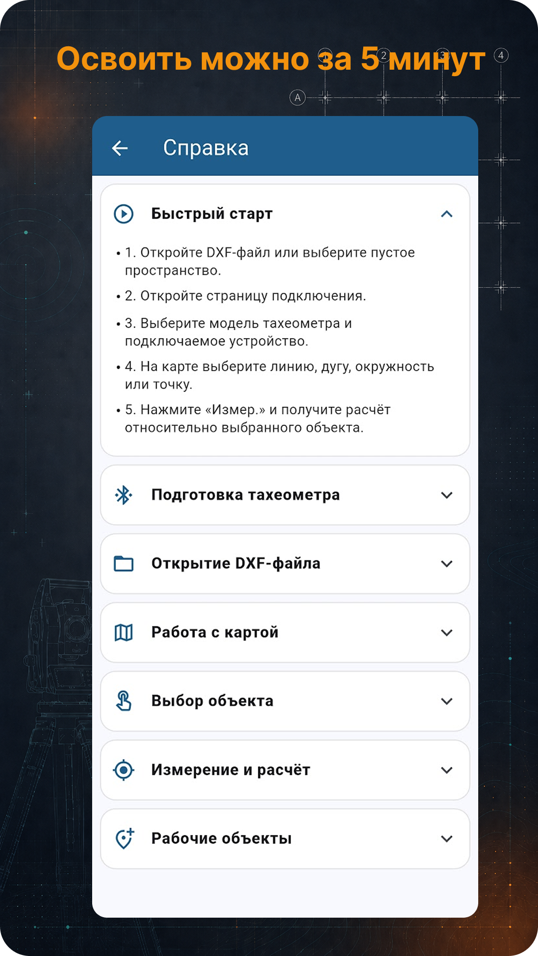
An app for total station work with a field project. Connect to the instrument, open a DXF layout file, select a design line, point or object, measure points and check their position against the project.
An app for optical leveling on construction sites: benchmark, staff reading, instrument horizon, height, elevation marks, setting-out and level survey.
Documents
Terms of use, payment, access and data processing for GeoSystems Studio apps.