Total station
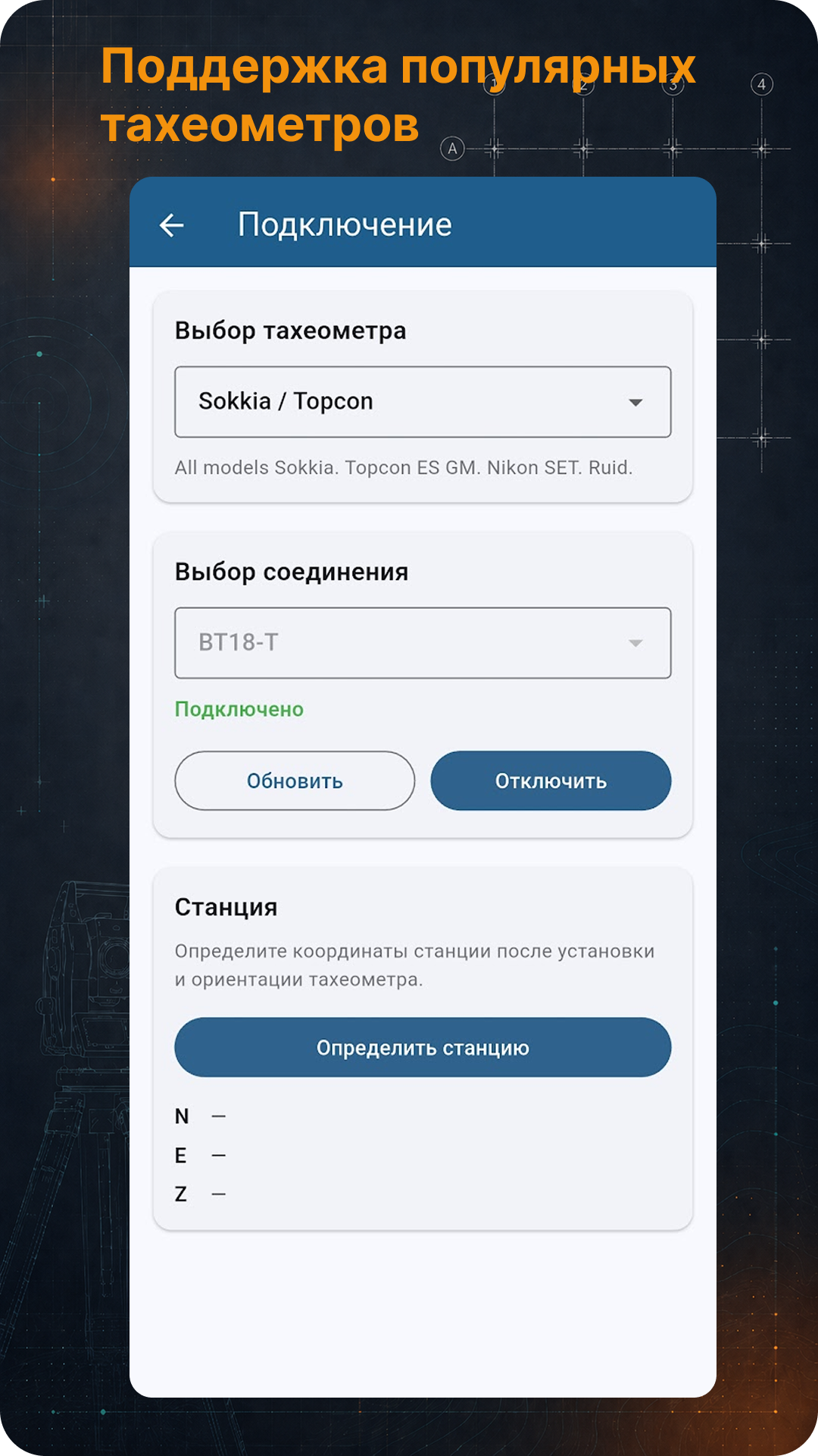
Connect to supported instruments and receive measured point coordinates.
TS Go!
Open a DXF layout, connect a total station, measure a point and get its position against the project: line, offset, elevation, point stakeout and survey.
A field tool for surveyors: total station, project, DXF, stakeout and control.
Features
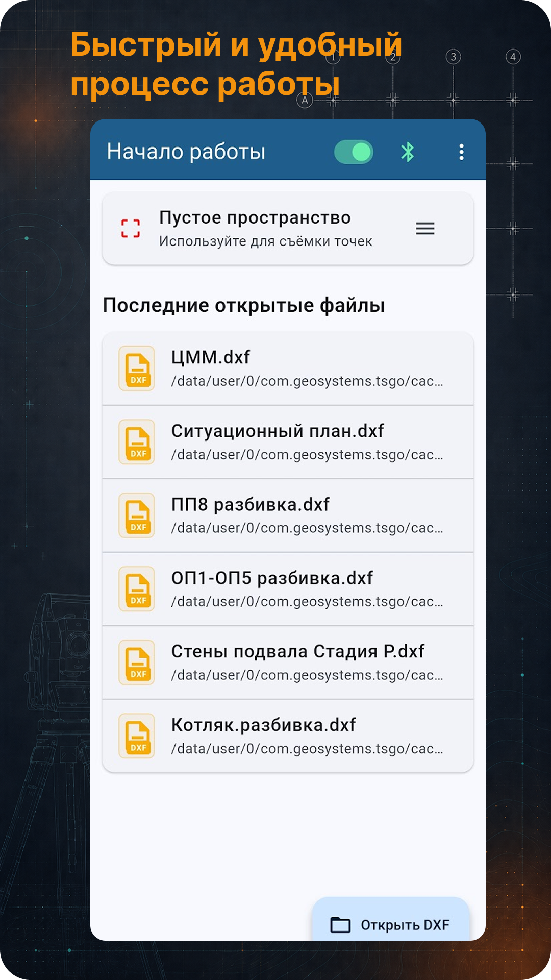
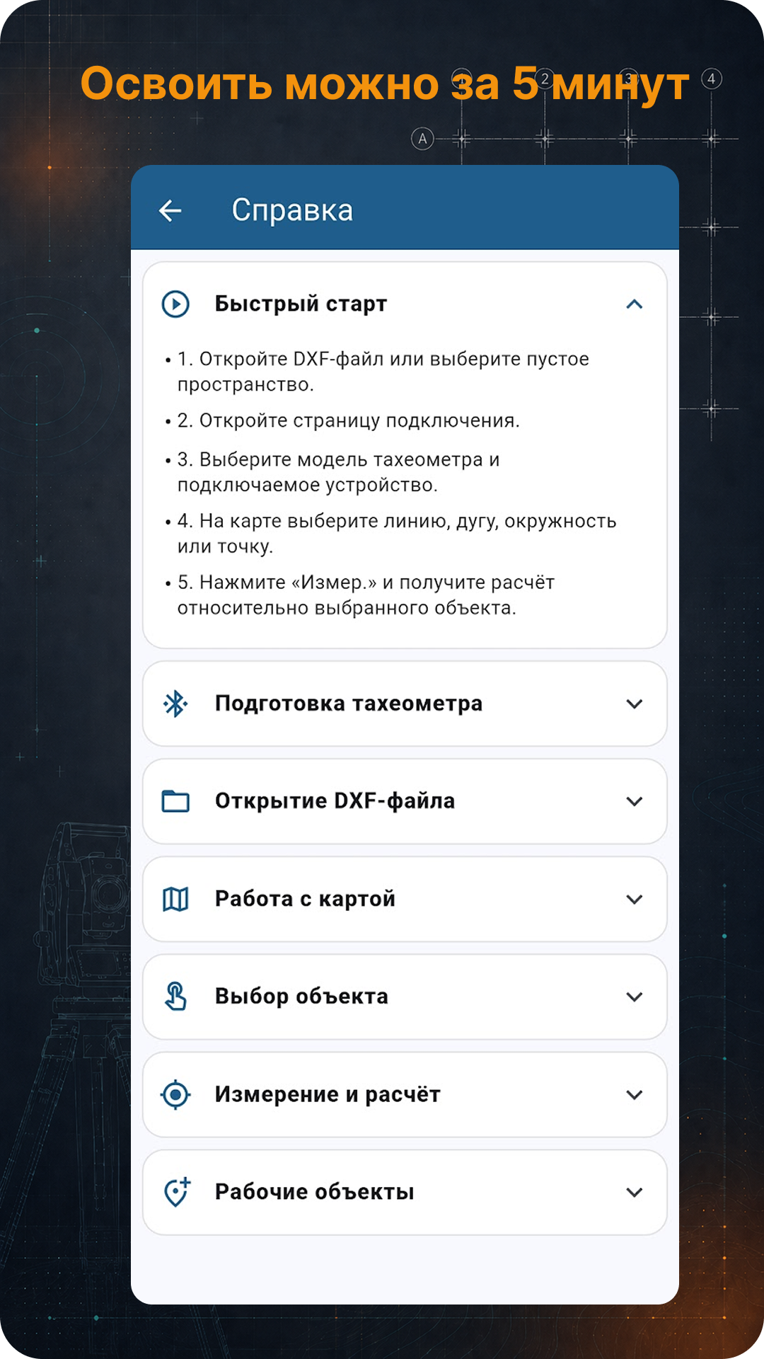
The app is built around a simple field workflow: open a project, select an object, measure a point and immediately understand the result.
Connect to supported instruments and receive measured point coordinates.
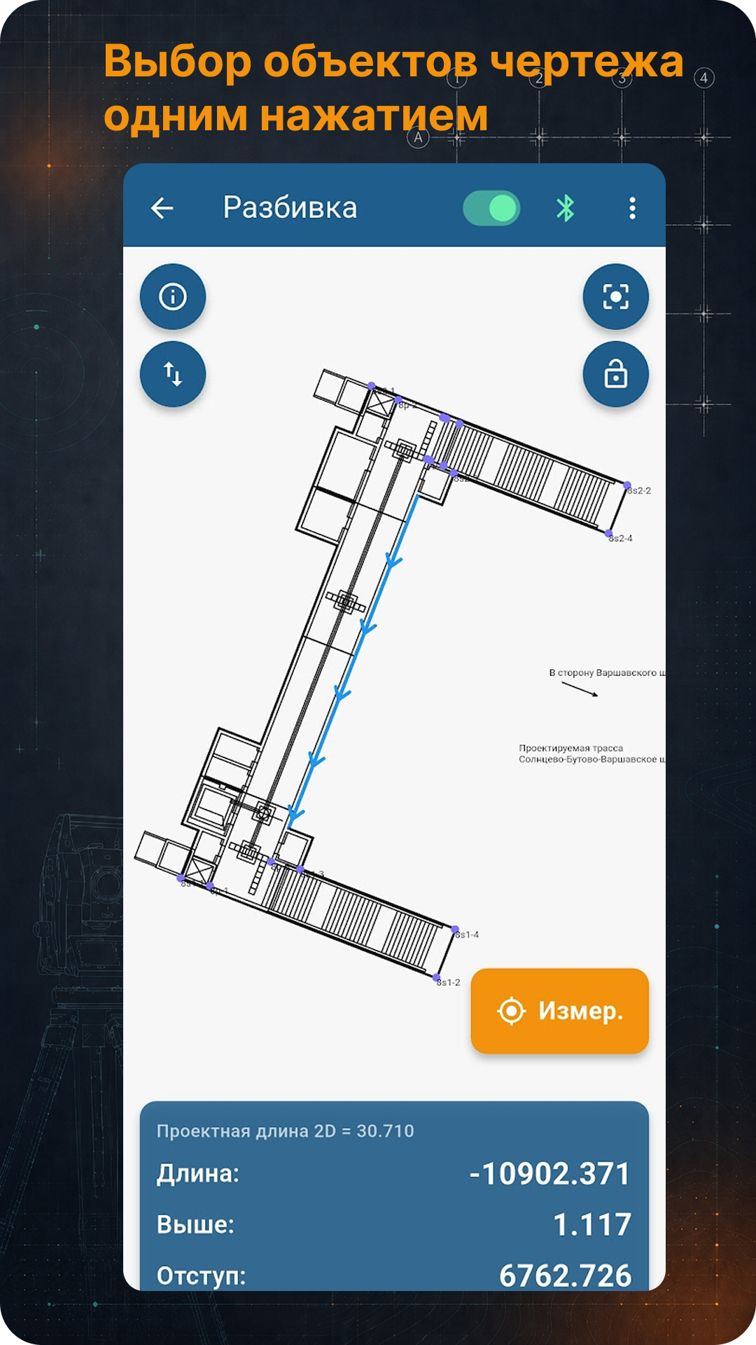
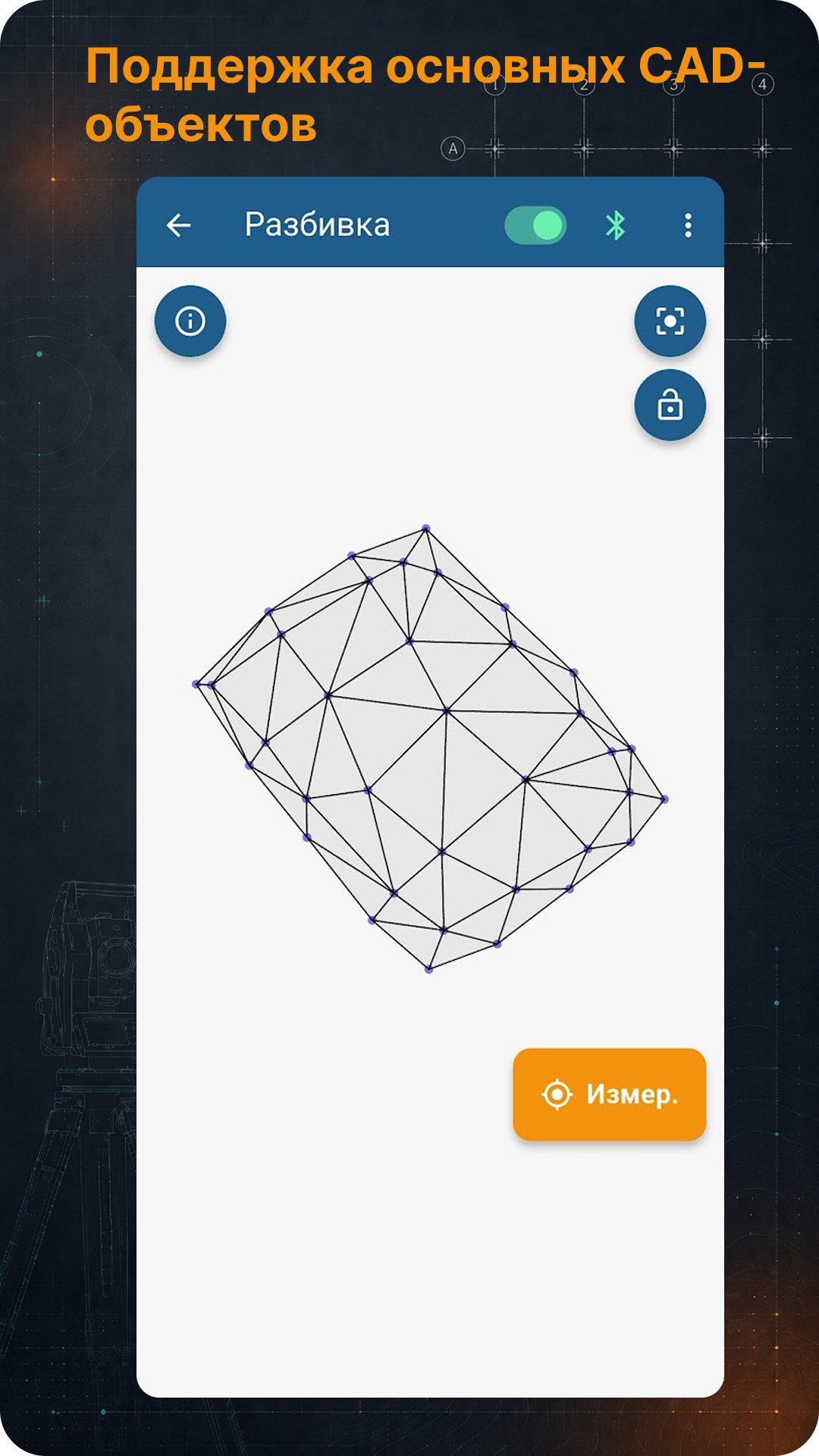
Open layout files, display CAD objects and work with lines, points, arcs and circles.
Field parameters against the project: chainage, offset, up/down, left/right, forward/back and turn angle.
Create working base lines from points and reverse line direction quickly.
A lightweight workspace for measured points, saving, export and cleanup.
Elevation control against design 3D surfaces is being developed in current versions.
Screenshots
The screenshot carousel scrolls horizontally.
Compatibility
TS Go! includes communication profiles for common total station families and receives measured coordinates directly from the instrument.
Communication profiles for instruments using the SET protocol.
Leica GSI and GeoCOM communication profiles.
Nikon profiles for compatible Nikon, Spectra Precision and Trimble models.
Topcon GTS profile and compatible protocols used by selected South, Kolida, CHC, Sanding and Gowin models.
Compatibility depends on the model, firmware, selected protocol and Bluetooth/COM settings. Test communication with the specific instrument before field work.
Access
The app is available in RuStore and as an APK from the official website. Access terms are shown inside the app. PRO access is time-limited and has no auto-renewal.